About Sialan Peak ( Alamut )
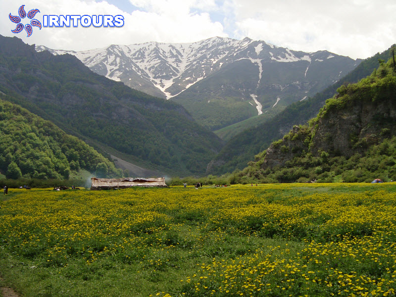
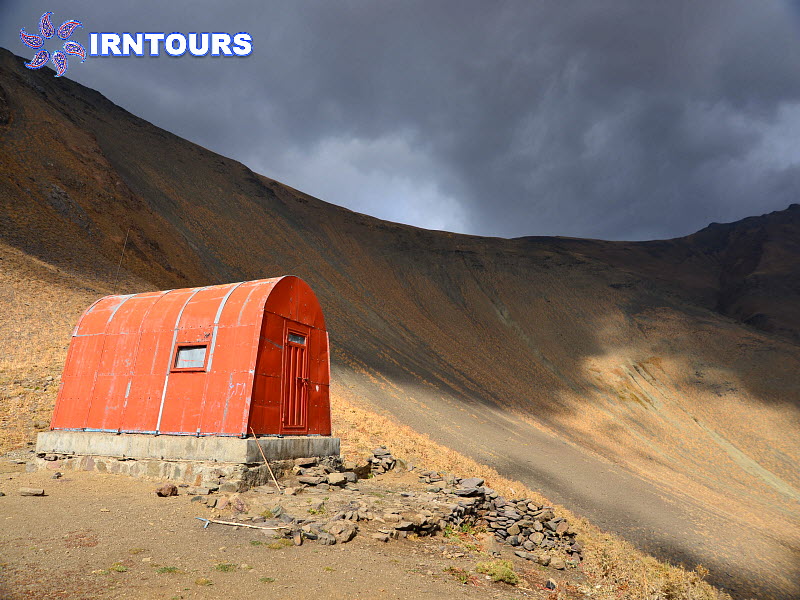
Sialan It is the name of a mountain located in the central Alborz mountain region and on the border of Mazandaran and Qazvin provinces. This mountain overlooks Do-hezar valley and Daryasar plain of Tonekaban city in Mazandaran province from the north and the eastern Alamut river section in Qazvin province from the south. Sialan peak is 4175 meters above sea level. This peak has one refuge on the north side and one on the south side, and you can climb to Sialan from three routes. From the top of Sialan peak, you can see Takht Suleiman, Alam Kouh, Shah Rashid and Samamos peaks and a piece of the beautiful Damavand peak.
Climbing routes Sialan Peak
In general, Sialan peak can be climbed from the northern, southern and ridge routes, and the northern and southern routes are navigated through Do-hezar and Haniz valleys, respectively.
The northern route, which starts from the village of Asal Mahaleh at an altitude of about 1,300 meters and passes through the Daryasar plain at an altitude of 1,700 meters and the memorial shelter at an altitude of 1,900 meters and passes through the Veni sheepfold, reaches the pass between Sialan and Kandigan peaks, which continues to The west side leads to Sialan peak. This route is longer than other routes.
The southern route starts from Haniz village at an altitude of 2,200 meters and by traveling to the north and passing through the snow tunnel spring, it reaches Jan Panah Sialan at an altitude of 3,250 meters.
The other way is to reach the peak by passing by the Tarulat river and climbing to the right side of the ridge at the end.
The path of the ridge that leads to the peak of Kashchal and then the peak of Kandikan and the navigation of the ridge to the peak of Sialan.
Geographical location of Sialan peak
Sialan peak can be considered the easternmost and highest peak in the west-east vertical line, which includes the main peaks of Samamos, Khoshchal, Kandigan and Sialan. This ridge starts from the south of Samamos peak and continues to the east to Sialan peak and Se-hazar valley. The northern slopes of the Sialan peak are located in the Tonekabon region; So that the northeastern slopes reach the Sehazar Valley and the northwestern slopes reach the Dohazar Valley. Also, its southern slopes overlook Qazvin city and Alamut valley.
View from Sialan Peak
If the weather is clear, you can see Takht Suleiman and Haft Khan peaks in the east and southeast, Khoshchal and Samamos peaks in the west and northwest, and Shah Alborz in the southeast from Sialan peak.
More information about Sialan Peak
Sialan Mountain is the source of Tange Chal, Hardurud, Daryasar and Etan rivers, all of which are part of the Caspian Sea catchment area. There are various narrations about the name of this peak; Some think the reason is the many black stones on the peak, and some think the strong wind and cold air of the peak, which leads to darkening of the skin. Some others consider the black clouds of the peak or the fact that the eyes turn black due to the low oxygen level on the peak as the reason for the name; But the reason that seems more reasonable is the existence of three ridges from the peaks of Kandigan, Beles Koh and Khanehban to this peak.
Question of Alamut & hashashins